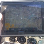
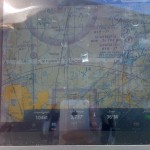
Today during my flying lesson, I was able to try out the new app I purchased for my iPad. Its called ForeFlight and it “provides access to high quality weather, airport intelligence, service providers, flight planning, and much more.” They also provide a huge selection of maps: “radar, satellite, IFR enroute (high or low), VFR sectional, flight rules, winds, temperatures, dew point spreads, ceilings, sky coverage, lightning,” etc. http://www.foreflight.com/ipad.
So I was up flying up at 3700+ and Instructor Cheryl took the controls so that I could play around with the app. Our airspeed, GPS Altitude, direction and location worked very well and were pretty accurate. The Sundowner showed up on the map as a cute little blue airplane icon.
Its a great tool to have around when you are flying, getting ready to fly, or even not flying (as the weather maps are great!).